Pacific Coast Highway Motorcycle Guide: Route, Stops & Timing
TL;DR — California's Pacific Coast Highway (CA-1) is one of the greatest motorcycle rides on earth: cliffs, ocean, and endless sweeping curves. Ride it north to south so you're on the ocean side of the road, plan around fog and fuel, and give yourself 3–5 days to do it right. Here's the full route, the stops that matter, and how to navigate it without draining your data.
Which Direction Should You Ride?
Ride the PCH north to south (San Francisco toward San Diego). In the US you drive on the right, so southbound puts you in the ocean-side lane — better views, easier photo pullouts, and you're not crossing traffic to reach every overlook. It also means the sun is generally behind you through the best cliff sections.
The Classic Route & Best Stops
| Segment | Highlights |
|---|---|
| San Francisco → Santa Cruz | Devil's Slide, Half Moon Bay, coastal cliffs |
| Santa Cruz → Monterey | Monterey Bay, Cannery Row, 17-Mile Drive |
| Monterey → Big Sur | Bixby Bridge, Big Sur coast — the crown jewel |
| Big Sur → San Simeon | Elephant seals, Hearst Castle |
| San Simeon → Santa Barbara | Morro Bay, Pismo Beach, wine country detours |
| Santa Barbara → Los Angeles | Malibu, Santa Monica |
| LA → San Diego | Laguna Beach, La Jolla |
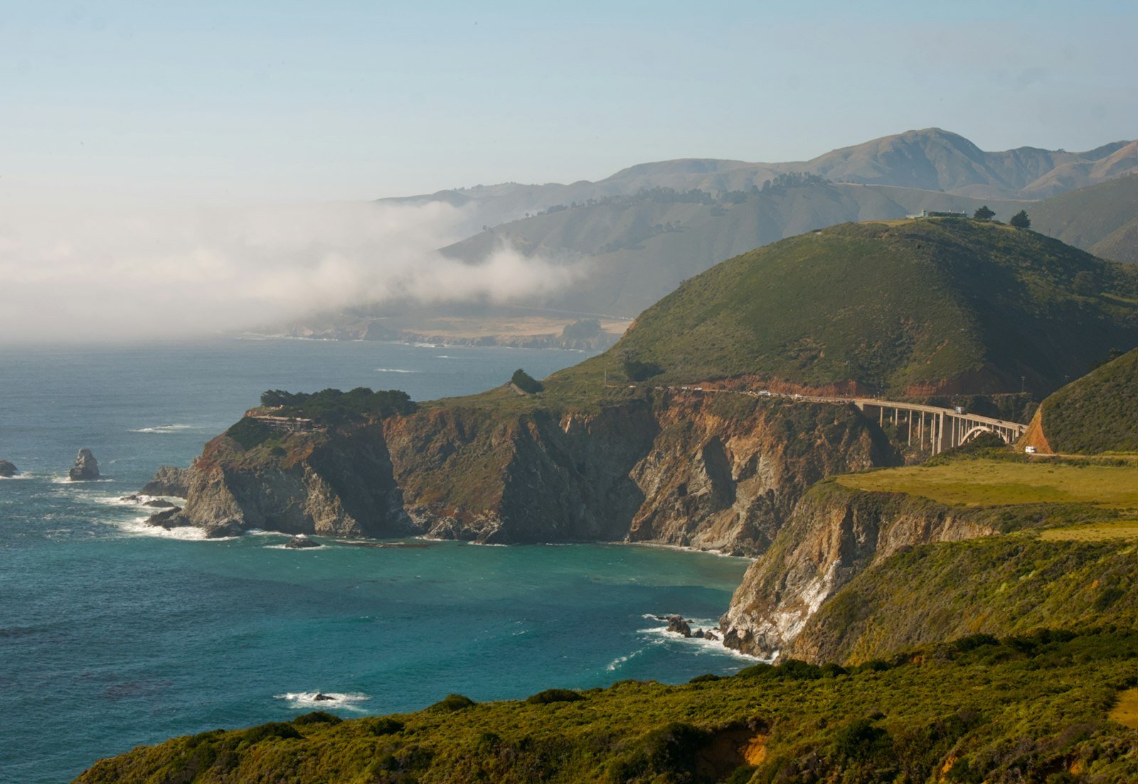
Don't-miss: The Bixby Creek Bridge and the Big Sur stretch are the postcard sections. Ride them early in the day before the fog and the RV traffic build up.
How Many Days?
You can blast SF to San Diego in two long days, but you'll miss the point. Give it 3–5 days. The road is slow by design — tight curves, 25–45 mph limits through Big Sur, and constant reasons to stop. A relaxed pace is where the magic is.
Fuel & Timing Planning
- Big Sur is the fuel gap. Gas stations are sparse and expensive between Carmel and San Simeon — fill up in Monterey/Carmel before you enter it.
- Fog is a daily factor. The coast often socks in with morning marine layer that burns off by midday. Plan your cliff sections for late morning to afternoon.
- Check for closures. Big Sur periodically closes due to landslides. Always confirm CA-1 is fully open before you commit to the route.
Best Time of Year
September and October are ideal — warm, the clearest skies of the year, and fewer summer crowds. Late spring is also good. Winter brings rain and a higher chance of landslide closures through Big Sur.
Navigating the Coast Without Killing Your Data
Cell coverage along Big Sur and the remote coastal stretches is patchy at best. Streaming maps over data will leave you staring at a spinning tile exactly where the road gets most interesting.
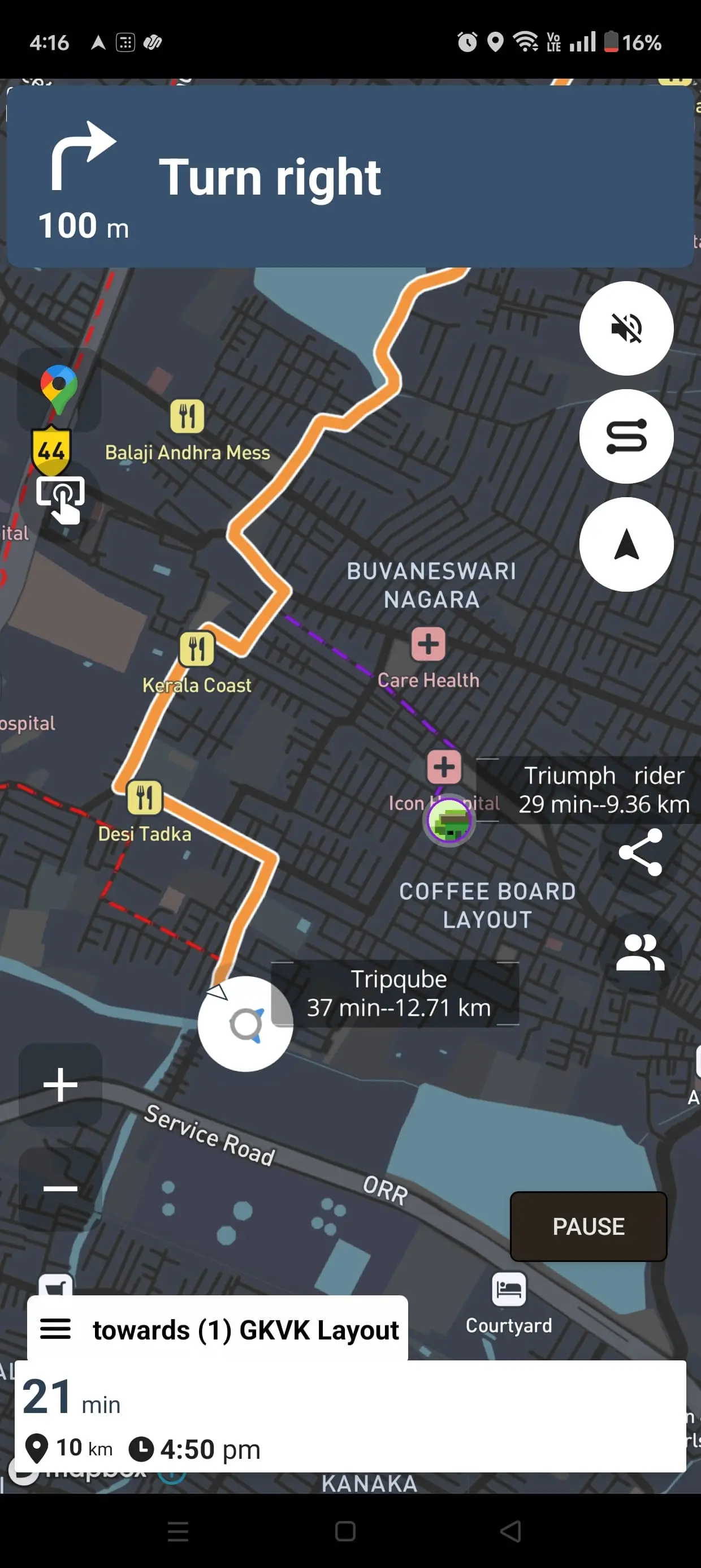
Plan the whole route in TripQube ahead of time — drop waypoints for Bixby Bridge, your fuel stop in Monterey, and each overnight — then download it for offline turn-by-turn navigation. Riding with friends? Live group tracking keeps everyone together through the curves without stopping to regroup at every pullout, and each rider can peel off for photos knowing they can see the group on one map.
Rider Tips for the PCH
- Pack layers — it can be 60°F and foggy on the coast and 90°F a few miles inland.
- Watch for gravel and sand on curves after windy days.
- Book Big Sur accommodation well ahead; it's limited and popular.
- Use the numbered pullouts to let faster traffic by — it keeps the ride relaxed for everyone.
Ready to Ride the Coast?
Map your PCH route, mark the fuel stops and overlooks, and carry it offline so you're never lost in the fog. Plan on the web, ride from your pocket.